Range Report Density & Pressure Altitude Charts

dareposte

Sergeant
Full Member
Minuteman
Mar 4, 2010
450
0
115
Grand Rapids, MI
www.dop3.com
I've been using DA lately for shooting, but was frustrated by not being able to find any good high-res charts to print out for pressure altitude and density altitude.

So I put these together as a PDF, maybe someone else can get some use out of them too.

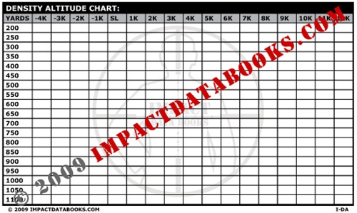
Density Altitude Chart
Pressure Altitude Chart
Both combined (for double-sided printers)

It works great with the Density-Altitude range card generator here: http://www.direkon.com/DA/

Step 1: Determine station pressure and temperature by any means available. I use my Kestrel or the local weather station.

Step 2: Use the Pressure-Altitude chart to figure the pressure altitude from the station pressure you got in step 1.

Step 3: Use the Density Altitude chart to determine the density altitude, using Pressure Altitude from Step 2 and Temperature from step 1.

Step 4: Go print out a range card for that density altitude, and take it to the range with you. Or if you have pre-printed a bunch like I have, just sift through the stack and use the right one.

The big advantage is that no batteries are required if you have an analog thermometer and barometer. If you carry any Kestrel then no Ballisic Computer is required at all.

I tend to bring my Kestrel 2500 and the charts, and it forms a pretty robust firing solution system. In a pinch I can guestimate the temperature & pressure fairly close and not be dead in the water if my Kestrel drowns. If you have a fancy enough kestrel it will compute DA for you directly, which is preferable to the charts in that its more accurate, but the charts are still handy in case the Kestrel dies or malfunctions.

The charts don't take into account humidity / dewpoint, but will get you pretty close.

 
Re: Density & Pressure Altitude Charts

Good to see it's back up again. Any chance that you can enable DA for MIL's?

Unless I'm missing something, it only does that for MOA?

Mark
 
Re: Density & Pressure Altitude Charts

To anyone who wants to think about leaving the kestrel in the truck or at home look at using these charts with a watch that measures barometric pressure and temp. I'm using a casio pathfinder with tough solar. Has anybody seen any other cool, simple devices for measuring barometric pressure, preferably without batteries. For me the watch is pretty simple, but other solutions would be pretty good to know as well (besides a weather station).
 
Re: Density & Pressure Altitude Charts

<div class="ubbcode-block"><div class="ubbcode-header">Originally Posted By: coolhandjoe</div><div class="ubbcode-body">To anyone who wants to think about leaving the kestrel in the truck or at home look at using these charts with a watch that measures barometric pressure and temp. I'm using a casio pathfinder with tough solar. Has anybody seen any other cool, simple devices for measuring barometric pressure, preferably without batteries. For me the watch is pretty simple, but other solutions would be pretty good to know as well (besides a weather station). </div></div>

Check out the Brunton ADC pocket altimeter, no batteries and it gives station pressure to the nearest 0.10" Hg.
http://www.amazon.com/Brunton-ADC-Ridge-...;sr=1-2-catcorr

Not to be confused with the "stock pocket" or "pocket rocket". Also NOT compatible with fleshlights.
 
Re: Density & Pressure Altitude Charts

I got one of them with my REI dividend. I haven't compared manual calcs to my Kestrel yet. Set the zero to 29.92 and you are reading pressure altitude for the graphs.
 
Re: Density & Pressure Altitude Charts

You can also use that charts and tools with our I-DA page to design your own page.

I-DA-2.jpg
 
Re: Density & Pressure Altitude Charts

Am I doing something wrong? Right now, it's 75*F, 29.92 "Hg, 18% humidity and a dewpoint of 29*F, and a station altitude of 3160'. Using the files from the OP, and 29.92"Hg as the station pressure, I get a pressure altitude of right around 0. Using the PA of 0 and temp of 75*F gives me a DA of around 1000'. But, when I plug the info above into one of the DA calculators found by google, it comes out to close to 4975' or so. Am I missing something?
 
Re: Density & Pressure Altitude Charts

The "Easy" way to get station pressure is out of a Kestrel or mechanical barometer.

Lacking those instruments, another way is to pull the METAR report for a station near you and compute it using the altimeter formula for aircraft.

For Rapid City, I pulled your METAR from NOAA:
2011/06/03 23:52 KRAP 032352Z 25012KT 10SM CLR 23/M01 A2994 RMK AO2 SLP125 T02331006 10250 20233 53014

It's reporting an altimeter setting of 29.94 in-Hg, basically what you said in your post. Altimeter setting pressure and sea-level pressure from the weather channel are not the same so this only works for Altimeter setting pressures. You don't need to understand it all clearly, just pull the METAR and get the word that starts with "A", in this case "A2994" means Altimeter setting 29.94 In-Hg.

To convert that to station pressure use this formula:

Station Pressure = Altimeter Setting * ( (288-0.0065*altitude)/288)^5.2561

With altitude in Meters.

So at Rapid City, an elevation you reported of 963 meters, the conversion is this:

Station Pressure = 29.94*((288-963*.0065)/288)^5.2561
Station Pressure = 29.94* 0.891 = 26.68 in-Hg

If you're going to just be shooting around that altitude, take whatever you find in the METAR report and multiply by 0.891 and you have Station Pressure.

Then from the charts on the OP, you find a station pressure about 3100ft, and using T=77F from the METAR you get a DA from the chart ~4900 feet.


______________ OR USE THIS EASIER METHOD ___________________

For shooting, it's sometimes easier to use another method and just remember that station pressure differs from sea level pressure by about 1 in-Hg for every 1000' of elevation. Using this as a guideline, you would just look at the weather channel "Sea Level Pressure" and find it is 29.92 in-Hg. You know you're at elevation 3160 feet, so just subtract 3.16" from the 29.92 reading and you'll be close.

In this case, 29.92-3.16 = 26.76, almost the same as we got using the METAR reports. For all practical purposes this will put you on target.

Hope that Helps!

 
Re: Density & Pressure Altitude Charts

Ok, so what the national weather service is reporting isn't station pressure, its altimeter setting pressure? I just assumed that what they had on their website was what they were measuring at their weather station at the airport. So, the barometric pressure number I get from the NWS will need to be corrected every time then? Good thing I'm not a weather guy. I don't shoot anywhere near the airport anyways, I was just grabbing the weather info from there to see if I could figure this out for the future. A kestrel will definitely be the way to go.

Thanks for the explanations.
 
Re: Density & Pressure Altitude Charts

The weather service reports "Sea Level Corrected" pressure. This is not the same as an Altimeter setting pressure. I believe they differ because SLP is corrected for non-standard temperature but Altimeter setting pressure assumes "standard" temperature.

Sea Level pressure is really just useful for comparing pressure trends across various elevations, it corrects your pressure at altitude as if you were at sea level, using an average daily temperature for the correction. If temperature is close to standard temperature for your elevation then altimeter setting and station pressure will be the same.

Also, pressure trends tend to be fairly broad. I use the airport pressure here in Grand Rapids and it matches up with my Kestrel at the shooting range almost always, if all I had was a weather channel pressure I wouldn't hesitate to use that to figure my density altitude.
 
Re: Density & Pressure Altitude Charts

Do you know of any good websites to get familiar with some of the equations and terminology? Most of my school books refer to gauge or absolute pressures, and I can't even locate them right now.
 
Re: Density & Pressure Altitude Charts

Here is a very siple way. It requires a phone. That's it. Rotary if you wish too
smile.gif


Call your local airports wx station. It's a pre recorded message that changes every hour or so. (ATIS)

For example, palm beach international is 561 683 2548.

You'll hear a pre recorded message, and if the DA is 1000 above the elevation there (maybe it was 1500) you will be told the DA. Pick an airport within 20 miles of you.

You can get the numbers from www.airnav.com

Go ahead and call your local wx asos station now, just a pre recorded message. Don't keep listening though, smaller airports it's 1 line and you'll hold up other pilots trying to call.
 
Re: Density & Pressure Altitude Charts

<div class="ubbcode-block"><div class="ubbcode-header">Originally Posted By: taseal</div><div class="ubbcode-body">Here is a very siple way. It requires a phone. That's it. Rotary if you wish too
smile.gif


Call your local airports wx station. It's a pre recorded message that changes every hour or so. (ATIS)

For example, palm beach international is 561 683 2548.

You'll hear a pre recorded message, and if the DA is 1000 above the elevation there (maybe it was 1500) you will be told the DA. Pick an airport within 20 miles of you.

You can get the numbers from www.airnav.com

Go ahead and call your local wx asos station now, just a pre recorded message. Don't keep listening though, smaller airports it's 1 line and you'll hold up other pilots trying to call.</div></div>

thanks for the tip!